
顾祝军
一、基本信息
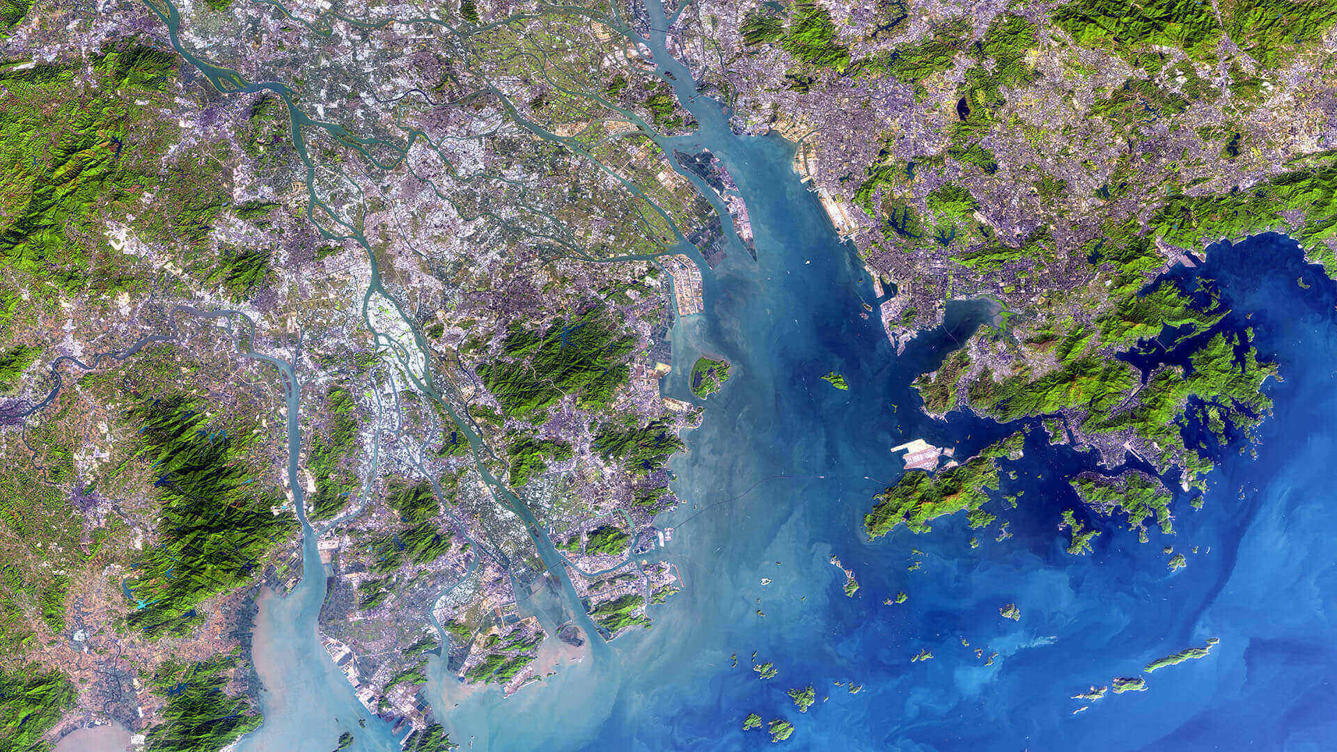
顾祝军,博士,教授,珠江水利委员会珠江水利科学研究院遥感所创新中心主任,中国地理信息系统协会教育与科普委员会委员、江苏省地理学会理事、江苏省遥感与GIS学会理事、南京欧美同学会理事。主要研究领域:AI遥感、植被遥感、水土保持、河湖监管。于南京师范大学、中国科学院获理学学/硕士及农学博士学位,于南京大学进行博士后研究,并赴韩国Honam大学和加拿大Alberta大学开展合作研究各一年。就水土耦合机理、AI遥感方法、植被结构反演等方面开展了深入持久的研究,主持国家自然科学基金面上项目3项(在研1项),江苏省自然科学基金面上项目1项,参加国家自然科学基金项目8项、国家重点基础研究发展计划项目5项。已发表学术论文80余篇,其中SCI收录论文40余篇,获得发明专利10余项、珠江委科技进步一等奖1项(排名第一)、全国GIS教学成果二等奖1项(排名第一)。成果广泛应用于水土保持、河湖监管、生态修复以及水利工程安全监测等领域。2016年破格晋升教授职称。曾被评为南京市建邺区 “精神文明建设先进个人”、江苏省高校“青蓝工程”中青年学术带头人、珠江水利科学研究院“最美奋斗者”。
常用联系方式:
手机(微信):13951751469
QQ:305685769
E_mail:
zhujungu@163.com
二、主要承担项目
1、研究项目
(1) 林下水蚀区植被三维绿量恢复度多角度遥感反演研究(No. 41071281),38万元,2011-01至2013-12,国家自然科学基金委员会面上项目,主持
(2) 基于多角度光谱和纹理信息的林地植被结构分层遥感反演研究(No. BK20131078),10万元,2013-07至2017-07,江苏省自然科学基金委员会面上项目,主持
(3) 林地植被水土保持结构化叶面积指数(FSL):多角度和垂向集成的分层遥感估算及应用研究(No. 41571415),72万元,2016-01至2019-12,国家自然科学基金委员会面上项目,主持
(4) 长汀县生态环境质量时空变化遥感反演研究,28万元,2019-01至2019-12,长汀县林业发展有限公司,长汀县2019年水土流失精准治理深层治理项目,主持
(5) 集成无人机广义点云的水蚀区植被覆盖度遥感反演研究,55万元,2021-06至2021-12,珠江水利委员会珠江水利科学研究院创新项目,主持
(6)粤港澳大湾区水安全要素”空-天-地“立体观测关键技术((2021)国科科函字第130号),150万元,2022-01至2023-10,水利部国科司重点研发项目,专题主持
(7) 水利遥感AI关键落地技术研究,30万元,2022-05至2023-12,珠江水利委员会珠江水利科学研究院创新项目,主持
(8) 基于多谱段背景反射率的林地水土保持层析植被覆量遥感研究(No. 32371966),50万元,2024-01至2027-12,国家自然科学基金委员会面上项目,主持
(9) 长三角一体化示范区水土流失监测分析评价,12万元,2024-05至2024-12,太湖流域管理局太湖流域水土保持监测中心站创新项目,主持
2、应用项目
(1) 2021年度水利部水土保持监管遥感解译与判别项目(No. BRR21-ZB1-ZB- 32-02),142万元,2021-05至2021-11,水利部水土保持监测中心,水利部财政专项资金项目,主持
(2) 江苏省2021年度水土保持信息化监管Ⅰ标项目(No. JS2021SB-JC1),110.96万元,2021-05至2021-11,江苏省水土保持生态环境监测总站,江苏省财政专项资金项目,专题主持
(3) 2022年度水利部水土保持监管遥感解译与判别项目(No. BRR-2022-ZB1- ZB-025-02),1919万元,2022-05至2022-11,水利部水土保持监测中心,水利部财政专项资金项目,专题主持
(4) 深圳市智慧水务一期工程-水土保持信息化建设项目(No. [2022] ZX124),遥感影像AI智能解译模型,80万元,2022-03至2022-09,深圳市水务局,主持
(5) 无锡市水土保持监测遥感信息处理等技术支撑协作项目(2022年)(No.JSJGWXCG2022-08),52万元,2022-09至2023-09,江苏省水文水资源勘测局无锡分局,主持
(6) 数字孪生大藤峡建设(一期)项目(DTX202209),库区岸线、河湖“四乱”及崩塌滑坡AI遥感,64万元,2022-09至2023-12,广西大藤峡水利枢纽开发有限责任公司,主持
(7) 江苏省2022年度水土流失动态监测项目(No. JSZC-320000- HYGS- G2022- 0009),130万元,2022-04至2022-11,江苏省财政专项资金项目,江苏省水土保持生态环境监测总站,主持
(8) 江苏省2023年度水土流失动态监测项目(No. JSZC-320000- HYGS- G2023- 0015),150万元,2023-05至2024-03,江苏省财政专项资金项目,江苏省水土保持生态环境监测总站,主持
(9) 广东省智慧水利一期—水土保持(No.[2023]ZX212),340.578万元,2023-05至2025-05,广东省财政专项资金项目,广东省水利厅,主持
(10) 无锡市水土保持监测遥感信息处理等技术支撑协作项目(2023年)(No.JSJGWX20230831),23.65万元,2023-09至2024-09,江苏省水文水资源勘测局无锡分局,主持
(11) 水生态生产建设项目、水土流失监测治理成果数据运营服务及水土保持人工智能模型构建服务、水土保持遥感影像实时运营服务项目,452.50万元,2024-01至2026-06,广东省财政专项资金项目,广东省水利厅,主持
(12) 云南省保山市森林火灾高危区森林防火应急道路建设项目水土保持方案编制及水土保持验收服务,144万元,2024-02至2024-12,中央财政专项资金项目,保山市林业和草原局,主持
(13) 桂城瀚天专精特新产业园(三山东区园)水土保持方案编制及施工期监测,10万元,2024.03至2026.12,广东瀚天投资发展有限公司,主持
(14) 瀚天大湾区智造产业科技园建设项目水土保持方案及施工期监测,8万元,2024.10至2026.12,广东瀚天投资发展有限公司,主持
三、主要荣誉称号
(1) 精神文明建设先进个人,县处级,授予(实施)单位:南京市建邺区人民政府,入选时间:2000年
(2) 江苏省高校“青蓝工程”优秀中青年学术带头人,省部级,授予(实施)单位:江苏省教育厅,入选时间:2012年
(3) 教学科研“双优模范教师”,厅局级,授予(实施)单位:南京晓庄学院,入选时间:2016年
(4) 珠江水利科学研究院“最美奋斗者”,厅局级,授予(实施)单位:珠江水利科学研究院,入选时间:2023年
四、主要获奖情况
(1) “行知精神”在地理信息科学专业课程思政中的实践探索,第二届全国高等学校GIS教学成果奖二等奖,本人排名1/7, 授予部门:教育部高等学校地理科学类专业教学指导委员会, 中国地理信息产业协会教育与科普工作委员会,2019年6月
(2) 林下水蚀区植被三维绿量恢复度多角度遥感及应用,2021年度珠江水利委员会科学技术奖一等奖,本人排名1/8,授予部门:珠江水利委员会珠江水利科学研究,2021年12月
五、主要学术成果
- SCI 期刊论文
(1)Gu Zhujun, Zeng Zhiyuan, Shi Xuezheng, Li Lin, Yu Dongsheng, Zheng Wei, Zhang Zhenlong, and Hu Zifu. Assessing factors influencing vegetation coverage calculation with remote sensing imagery. International Journal of Remote Sensing, 2009, 30(10): 2479-2489.
(2) Gu Zhujun, Zeng Zhiyuan*, Shi Xuezheng, Li Lin, Weindorf D.C., Zha Yong, Yu Dongsheng, and LiuYongmei. A model for estimating total forest coverage with ground-based digital photography. Pedosphere, 2010, 20(3): 318-325.
(3) Gu Zhujun, Shi Xuezheng*, Li Lin, Yu Dongsheng, Liu Liusong, and Zhang Wentai. Using multiple radiometric correction images to estimate leaf area index. International Journal of Remote Sensing, 2011, 32(24): 9441-9454.
(4) Zhang Wentai, Yu Dongsheng, Shi Xuezheng, Wang Hongjie, Gu Zhujun, Zhang Xiangyan, and Tan Manzhi. The suitability of using leaf area index to quantify soil loss under vegetation cover. Journal of Mountain Science, 2011, 8: 564-570.
(5) Gu Zhujun, Ju Weimin, Liu Yibo, Li Dengqiu, and Fan Weiliang. Applicability of spectral and spatial information from IKONOS_2 imagery in retrieving leaf area index of forests in the urban area of Nanjing, China. Journal of Applied Remote Sensing, 2012, 6(1): 063556-1~14.
(6) Gu Zhujun, Ju Weimin*, Li Lin, Li Dengqiu, Liu Yibo, and Fan Weiliang. Using vegetation indices and texture measures to estimate vegetation fractional coverage (VFC) of planted and natural forests in Nanjing City, China. Advances in Space Research, 2013, 51: 1186-1194.
(7) Gu Zhujun, Ju Weimin, Liu Yibo, Li Dengqiu, and Fan Weiliang. Forest leaf area index estimated from tonal and spatial indicators based on IKONOS_2 imagery. International Journal of Remote Sensing Application, 2013, 3(4):175-184.
(8) Gu Zhujun*, Wu Xiaoxia, Zhou Feng, Luo Hao, Shi Xuezheng, and Yu Dongsheng. Estimating the effect of Pinus massoniana Lamb plots on soil and water conservation during rainfall events using vegetation fractional coverage. Catena, 2013, 109:225-233.
(9) Gu Zhujun*, Wu Xiaoxia, Wang Xiaolei, Peng Shaoyun, Luo Hao, Shi Xuezheng, and Yu Dongsheng. Using live vegetation volume to analyze the effects of plot Pinus massoniana Lamb on water and soil conservation under natural rainfall events. International Journal of Sediment Research, 2013, 28(4):579-587.
(10) Fan Weiliang, Ju Weimin, and Gu Zhujun. Method for reconstruction the pixel missing region on remote sensing images. Journal of Applied Remote Sensing, 2013, 7: 073536-1~8.
(11) Zhou Feng, Gu Zhujun, Hua Chun, Chen Quanzhan, Zhang Bianjiang, and Shao Hongbo. Photosynthetic activity enhancement by reconstituting spinach light-harvesting complexes II and photosystem II core complexes into liposomes. Jokull Journal, 2013,63(9):387-401.
(12) Wu Xiaoxia, Gu Zhujun*, Luo Hao, Shi Xuezheng, and Yu Dongsheng. Analyzing forest effects on runoff and sediment production using leaf area index. Journal of Mountain Science, 2014, 11(1):119-130.
(13) Zhou Feng, Qiu Nianwei, Gu Zhujun, Zhang Bianjiang, and Hua Chun. Thermal stability studies of photosystem II complexes reconstituted into phosphatidylcholine liposomes. Russian Journal of Plant Physiology, 2014, 61(1): 26-32.
(14) Cao Jianjun, Gu Zhujun*, Xu Jianhua, Duan Yushan, Liu Yongmei, Liu Yongjuan, and Li Dongliang. Sensitivity analysis for Leaf Area Index (LAI) estimation from CHRISPROBA data. Frontiers of Earth Science, 2014, 8(3):405-413.
(15) Li Dengqiu; Ju Weimin*; Fan Wenyi; Gu Zhujun. Estimating the age of deciduous forests in northeast China with Enhanced Thematic Mapper Plus data acquired in different phenological seasons. Journal of Applied Remote Sensing, 2014, 8(1): 112-127.
(16) Zhang Haidong, Yu Dongsheng, Dong Linlin, Shi Xuezheng, Warner Eric, Gu Zhujun, Sun Jiajia. Regional soil erosion assessment from remote sensing data in rehabilitated high density canopy forests of southern China. Catena, 2014, 123: 106-112.
(17) Gu Zhujun, Wu Xiaoxia , Zhou Feng, Sanchez-Azofeifa G.A., Feng Jilu, and Qiu Nianwei. Analysis of time scale influences on water and soil conservation effects for trees on plots using vegetation fractional coverage. Forest Science, 2014, 61(1):67-75.
(18) Gu Zhujun, Sanchez-Azofeifa G.A., Feng Jilu, and Cao Sen. Predictability of leaf area index (LAI) using vegetation indices from mult-iangular CHRIS/PROBA data over eastern China. Journal of Applied Remote Sensing, 2015, 9: 096085-1~15.
(19) Cao Sen, Yu Qiuyan, Arturo Sanchez-Azofeifa, Jilu Feng, Benoit Rivard, Gu Zhujun, Mapping tropical dry forest succession using multiple criteria spectral mixture analysis. ISPRS Journal of Photogrammetry and Remote Sensing, 2015, 109: 17-29
(20) Liu Jingtao, Gu Zhujun, Shao Hongbo, Zhou Feng, Peng Shaoyun. N-P stoichiometry in soil and leaves of Pinus massoniana forest at different stand ages in the subtropical soil erosion area of China. Environmental Earth Sciences,2016,75(14):1-9.
(21) Wu Xiaoxia, Gu Zhujun*, Liu Zhenbo and Zhu Gaolong. Time scale influence on water and soil conservation effect of plot trees in Southern China. Journal of Environmental Biology, 2016, 37(3):463-471.
(22) Zhang Wentai, Hu Guiqing, Sheng Jiandong*, David C. Weindorf, Wu Hongqi, Xuan Junwei, Yan An, and Gu Zhujun. Estimating effective soil depth at regional scales: Legacy maps versus environmental covariates. Journal of Plant Nutrition and Soil Science,2017, 181(2):167-176.
(23) Wang Xiaolei, Yang Hao, Gu Zhujun, Zhang Mingli, Yang Benjun. A century of change in sediment accumulation and trophic status in Lake Fuxian, a deep plateau lake of Southwestern China. Journal Soils Sediments, 2018, 18:1133-1146.
(24) Gu Zhujun, Cao Sen, Sanchez-Azofeifa G.A. Using LiDAR waveform metrics to describe and identify successional stages of tropical dry forests. International Journal of applied earth observation and geoinformation, 2018, 73:482-492.
(25) Wang Xiaolei*, Xue Bin*, Yao Shuchun , Yang Hao , Gu Zhujun , Yang Benjun, Zhang Mingli, Zhu Ying.137Cs estimates of soil erosion rates in a small catchment on a hannelized river floodplain in the lower reaches of Yangtze River, China. Journal of Environmental Radioactivity, 2019, 208-209.
(26) Wu Xiaoxia, Gu Zhujun*. Contribution Weight of Forest Canopy and Grass Layers to Soil and Water Conservation on Water-Eroded Areas in Southern China. Eurasian Soil Science, 2020, 53(7):1004-1012.
(27) Feng Jiangfan, Wang Dini & Gu Zhujun. Bidirectional flow decision tree for reliable remote sensing image scene classification. Remote Sensing, 2022, 14, 3943.
(28) Zhang Shanyong, Li Ning, Xu Mingshuai, Huang Zheng, Gu Zhujun & Yin Shenglai. Urbanization and habitat characteristics associated with the occurrence of peste des petits ruminants in Africa. Sustainability, 2022, 14, 8978.
(29) Wu Bingxiao, Zheng Guang, Zhaning Wuming, Chen Yang, Gu Zhujun, Zeng Maimai & Li Aiguang. Simulating the distribution of rainfall interception ratio in a Masson’s pine plot using terrestrial laser scanning data. Hydrological Processes, 2022,36(10):e14712.1-e14712.17.
(30) Li Dongliang, Gu Zhujun*, Wu Xiaoxia, Yue Hui, Peng Shaoyun & Wang Xiaolei. Seasonal variations of forest leaf area index and its thermal effect on water-eroded areas in 2000–2014 using remote sensing imageries. Journal of Environmental Biology, 2022, 43(5):643-650.
(31) Zheng Wei, Feng Jiangfan *, Gu Zhujun and ZengMaimai. A stage-adaptive selective network with position awareness for semantic segmentation of lulc remote sensing images. Remote Sensing, 2023, 15(11): 2811-2835.
(32) Feng Jiangfan, Yang Xinyu, Gu Zhujun, Zeng Maimai and Zheng Wei. SMBCNet: A transformer-based approach for change detection in remote sensing images through semantic segmentation. Remote Sensing. 2023, 15: 3566-3587.
(33) Feng Jiangfan, Chen Panyu, Gu Zhujun, Zeng Maimai & Zheng Wei. MDSNet: A multiscale decoupled supervision network for semantic segmentation of remote sensing images. International Journal of Digital Earth, 2023, 16(1): 2844–2861.
(34) Feng Jiangfan, Liu Juntao, Gu Zhujun & Zheng Wei. OAMSFNet: Orientation-aware and multi-scale feature fusion network for shadow detection in remote sensing images via pseudo shadow. International Journal of Remote Sensing, 2023, 44(17): 5473–5495.
(35) Feng Jiangfan, Zheng Wei, Gu Zhujun, Guo Dongen and Qin Rui. A position-aware attention network with progressive detailing for land use semantic segmentation of remote sensing images. International Journal of Remote Sensing, 2023, 44(21): 6762–6801.
(36) Gu Zhujun*, Zeng Maimai. The use of artificial intelligence and satellite remote sensing in land cover change detection: review and perspectives. Sustainability, 2024, 16(1): 274-296.
(37) Feng Jiangfan, Yang Xinyu, and Gu Zhujun. SGNet: A transformer-based semantic-guided network for building change detection. IEEE Journal of Selected Topics in Applied Earth Observations and Remote Sensing, 2024, 17: 9922-9935.
(38) Feng Jiangfan, Wang Shiyu, Gu Zhujun. A novel sea-land segmentation network for enhanced coastline extraction using satellite remote sensing images. Advances in Space Research, 74 (2024) : 2200–2213.
(39) He Yanzi, Tian Zhiyuan, Gu Zhujun, Wu Bingxiao, Yin Liang. Controlling soil erosion of tailings from rare earth mines with Paspalum wettsteinii and soil amendments. Land Degradation & Development, 2024, 0:1–16.
- 英文核心期刊论文
(1) Gu Zhujun, Zeng Zhiyuan, Shi Xuezheng, Yu Dongsheng, Zheng Wei, Zhang Zhenlong , and Hu Zifu. Estimating models of vegetation fractional coverage based on remote sensing images at different radiometric correction levels. Frontiers of Forestry in China, 2009, 4(4): 402-408.
(2) Gu Zhujun, and Liu Jiaxue. Estimating Vegetation vertical density through a SPOT 5 imagery at multiple radiometric correction levels. Forestry Studies in China, 2012, 14(1): 55-62.
(3) Zeng Zhiyuan, Cao Jianzhou, Gu Zhujun, Zhang Zhenlong, Zheng Wei, Cao Yaqiao, and Peng Huaiyu. Dynamic monitoring of plant cover and soil erosion using remote sensing, mathematical modeling, computer simulation and GIS techniques. American Journal of Plant Science, 2013, 4:1466-1493.
(4) Gu Zhujun, Ju Weimin, Liu Yibo, Li Dengqiu, and Fan Weiliang. Forest leaf area index estimated from tonal and spatial indicators based on IKONOS_2 imagery. International Journal of Remote Sensing Application, 2013, 3(4):175-184.
(5) Peng Shaoyun, Gu Zhujun*, Xiu Ping. Comparison of water and soil conservation effect of trees, shrub and grasses in the red soil area of southern China. Asian Agriculture Research, 2013,5(10):106-110,116.
(6) Wu Xiaoxia,Gu Zhujun*. The Influence of Time Scale on the Quantitative Study of Soil and Water Conservation Effect of Grassland. Asian AgriculturalResearch, 2015,7(4):69-74.
(7) Gu Zhujun*, Luo Hao. Effects of three-dimensional structure of vegetation on particle size distribution and nutrient content of water-eroded red soil, Agricultural Science & Technology, 2016, 17(2):453-459.
(8) Wu Xiaoxia,Gu Zhujun*. Study on water and soil conservation effects of grassland based on Live Vegetation Volume at various time scales. Meteorological and Environmental Research, 2016,7(4):31-36.
- 中文核心期刊论文(有英文摘要)
(1) 顾祝军,曾志远.虚拟现实技术在我国农业现代化中的应用.农机化研究,2005(01):12-14.
(2) 顾祝军,曾志远.遥感植被盖度研究.水土保持研究,2005(02):18-21.
(3) 顾祝军.植被覆盖度的照相法测算及其与植被指数关系研究.南京师范大学,2005.
(4) 徐茂,王绪奎,顾祝军,沈其荣.江苏省环太湖地区速效磷和速效钾含量时空变化研究.植物营养与肥料学报,2007(06):983-990.
(5) 顾祝军,曾志远,史学正,郑伟,张振龙,胡子付.基于ETM~+图像的植被覆盖度遥感估算模型.生态环境,2008(02):771-776.
(6) 顾祝军,曾志远,史学正,于东升,郑伟,张振龙,胡子付.基于遥感图像不同辐射校正水平的植被覆盖度估算模型.应用生态学报,2008(06):1296-1302.
(7) 张文太,于东升,史学正,张向炎,王洪杰,顾祝军.中国亚热带土壤可蚀性K值预测的不确定性研究.土壤学报,2009,46(02):185-191.
(8) 曹亚乔,曾志远,曹建洲,顾祝军,张振龙,郑伟,田忠文.常用卫星图像数据光谱变换新方法.环境保护与循环经济,2009,29(10):17-19.
(9) 顾祝军,陈子玉,钟冠.基于SPOT5影像多辐射校正水平的植被绿量遥感估算.生态环境学报,2009,18(06):2294-2299.
(10) 孙佳佳,于东升,史学正,顾祝军,张文太,杨浩.植被叶面积指数与覆盖度定量表征红壤区土壤侵蚀关系的对比研究.土壤学报,2010,47(06):1060-1066.
(11) 顾祝军,刘咏梅,陆俊英.用多辐射校正水平遥感数据提取植被叶面积指数的精度分析.土壤学报,2010,47(06):1067-1074.
(12) 周峰,华春,顾祝军,秦晓春.盐酸胍对毕氏海蓬子类囊体膜蛋白光谱特征的影响.植物生理学报,2012,48(01):63-66.
(13) 邱念伟,周峰,顾祝军,贾树芹,王兴安.5种松属树种光合功能及叶绿素快相荧光动力学特征比较.应用生态学报,2012,23(05):1181-1187.
(14) 夏江宝,顾祝军*,周峰,刘京涛,彭绍云.红壤丘陵区不同植被类型土壤颗粒分形与水分物理特征.中国水土保持科学,2012,10(05):9-15.
(15) 曹建军,顾祝军*,徐建华,刘永娟.基于CHRIS/PROBA的植被叶面积指数估算模型研究.安徽农业科学,2013,41(02):907-910.
(16) 彭绍云,顾祝军*,修平.南方红壤试验小区乔灌草多年水土保持效应比较.水土保持研究,2013,20(01):25-29.
(17) 邱念伟,周峰,王颖,侯元同,顾祝军.松树与杨树叶片叶绿素快相荧光动力学特征比较.林业科学,2013,49(03):136-143.
(18) 邵劲松,浦牧野,顾祝军*.3种土壤微生物基因组DNA提取方法的比较.南京晓庄学院学报,2013,29(03):64-67.
(19) 陈子玉,顾祝军.南方水蚀区不同侵蚀程度土壤粒径分形研究.水土保持研究,2013,20(04):13-16+23.
(20) 孙涛,刘振波,葛云健,顾祝军.基于数码相片Gamma校正的水稻叶面积指数估算.生态学报,2014,34(13):3548-3557.
(21) 顾祝军, 林地植被结构的水土保持效应表征和遥感测量方法研究.江苏省,南京晓庄学院,2014-04-25.(科技成果)
(22) 王小雷,杨浩,顾祝军,张明礼.不同营养湖泊沉积物中210Pbex和营养盐垂向分布特征及相关性分析.环境科学,2014,35(07):2565-2571.
(23) 王小雷,杨浩,顾祝军,张明礼.抚仙湖沉积物中营养盐和粒度垂向分布及相关性研究.环境工程技术学报,2014,4(05):353-360.
(24) 吴晓霞,顾祝军*.时间尺度对草地水土保持效应定量研究的影响.水土保持研究,2014,21(05):59-65.
(25) 王小雷,杨浩,顾祝军,张明礼.抚仙湖沉积物重金属垂向分布及潜在生态风险评价.地球与环境,2014,42(06):764-772.
(26) 顾祝军,罗昊.植被三维结构对水蚀红壤粒径分布及养分含量的作用.江苏农业科学,2015,43(07):383-387.
(27) 刘振波,张丽丽,葛云健,顾祝军.基于环境卫星数据的森林叶面积指数遥感反演与验证——以大兴安岭加格达奇林区为例.林业科技开发,2015,29(04):126-130.
(28) 顾祝军.“遥感原理与应用”课程教学改革初探.大学教育,2015(10):108-109.
(29) 顾祝军,罗昊.植被三维结构对水蚀红壤粒径分布及养分含量的作用.江苏农业科学,2015,43(07):383-387.
(30) 吴晓霞,顾祝军*.不同时间尺度下基于绿量的草地水土保持效应研究.生态科学,2016,35(01):85-91.
(31) 郭忠明,顾祝军,吴红波,蒋熹,吴玉伟,陈安安.冰川雪线高度研究进展.遥感技术与应用,2016,31(04):645-652.
(32) 郭忠明,顾祝军,申保收.高校青年教师成长的问题及发展.教育现代化,2017,4(02):82-83.
(33) 孙越,顾祝军*,李栋梁.无人机与卫星影像的叶面积指数遥感反演研究.测绘科学,2021,46(02):106-112+145.
(34) 普颖颖,张文太,李政,顾祝军,黄国平,胡雨彤,赵红梅.伊犁河谷坡面管理措施对表层土壤储水和草被恢复的影响.中国水土保持,2021(03):34-37+62+9.
(35) 顾祝军,岳辉,王晓刚,曾麦脉,孟祥民,吴家晟,吴秉校,林带娣.基于TLS的水蚀区植被三维绿量垂直分布研究.亚热带水土保持,2021,33(04):16-20.
(36) 吴秉校,顾祝军,扶卿华,刘超群,曾麦脉,王晓刚,陈谢宁,吴家晟,林带娣,廖广慧,林权满,罗成,刘亚飞.遥感数据云平台在水土流失动态监测中的应用.中国防汛抗旱,2022,32(S1):60-64.
(37) 顾祝军,陈文龙,高阳,王旭东.中国城市水土流失的现状、对策及研究展望——以广东省深圳市为例.水土保持通报,2022,42(02):369-376.
(38) 顾祝军,曾麦脉,吴家晟,吴秉校,罗成,刘亚飞.水利遥感智能云平台HydrSAI建设及应用.人民长江.2024,55(8):239-245.
(39) 顾祝军, 刘斌, 朱骊, 丘仕能, 任小龙, 吴家晟, 肖斌, 廖广慧, 姚露露. 基于GF-1多光谱影像的河道碍洪物遥感AI识别模型.测绘通报.2024(8):84-89.
- 主要发明专利
(1) 一种简易地表双向反射率测量支架及测量方法,ZL201310345128.7,本人排名1/4.
(2) 一种抗盐胁迫真菌菌株及选育方法和其应用,ZL201410830686.7,本人排名3/4.
(3) 一种结合无人机影像的大空间尺度植被覆盖度计算方法,ZL201710651118.4,本人排名4/4.
(4) 一种基于DSM等高切片的植被覆盖度分层估算方法、介质,ZL202210205422.7,本人排名1/14.
(5) 房地产建设项目施工进度遥感大范围评估方法、介质,ZL202110589009.0,本人排名1/11.
(6) 一种影像切片边缘碎片快速探测与替换方法,ZL202110960853.X,本人排名7/10.
(7) 一种基于边界点的选择算法遥感图像语义分割方法,ZL 202211026393.4,本人排名1/9.
(8) 一种基于阴影的山体高度反演方法,ZL 202211025563.7,本人排名2/8.
(9) 基于地物光谱的无人机影像近红外波段模拟方法、介质,ZL202210853181.7,本人排名2/10.
(10) 一种基于像素级对比学习的遥感土地利用分类方法,ZL 202211018722.0,本人排名2/8.
(11) 一种图像解译图斑定位与精度评估方法,ZLCN202310110524.5,本人排名2/11.
(12) 基于尺度不变性的Gram-Schmidt变换空-谱融合方法,ZL 202311059572.2,本人排名4/9.
(13) 一种遥感影像蓝波段模拟方法、系统及可读存储介质,ZL 202310918046.0,本人排名3/7.
(14) 一种图像空-谱融合方法、系统及可读存储介质,ZL202311664851.1,本人排名3/7.
(15) 基于无人机山体阴影区植被覆盖度修正方法、设备和介质,ZL202310393541.4,本人排名7/8.
(16) 基于均值滤波的IHS空-谱融合方法、系统、设备及介质,ZL202310877785.X,本人排名2/9.
(17) 基于植被盖度特征幂次函数的遥感影像融合方法、系统及介质,ZL202410361492.0,本人排名2/9.
(18) 基于指数特征幂次函数的遥感影像融合方法、系统及介质,ZL202410370471.5,本人排名5/9.
- 软件著作权
(1)HydrSAI遥感云平台[简称:HydrSAI]V1.0,2022SR1080442,珠江水利委员会珠江水利科学研究院.
(2)生产建设项目水土保持管理信息系统[简称:水保管理系统]V1.0,2022SRO684939,珠江水利委员会珠江水利科学研究院.
(3) 基于降雨预报的生产建设项目水土流失风险预警系统[简称:水保预警]V1.0,2023SR0056216,珠江水利委员会珠江水利科学研究院.
(4) 水行政执法巡查APP[简称:执法巡查App]V1.0,2023SR0070585,珠江水利委员会珠江水利科学研究院.
(5) 水土流失动态监测APP[简称:动态监测APP ]V1.0,珠江水利委员会珠江水利科学研究院.
(6) 变化扰动图斑识别系统[简称:变化扰动识别 ]V1.0,珠江水利委员会珠江水利科学研究院.
- 学位论文
- 硕士论文:
顾祝军. 植被覆盖度的照相法测算及其与植被指数关系研究. 南京:南京师范大学, 2005.
- 博士论文:
顾祝军. 水蚀区“林下流”发生机理与植被恢复度的遥感监测研究. 南京: 中国科学院南京土壤所, 2008.
- 审稿经历
African Journal of Agricultural Research;
Agrotechnology;
Agricultural and Forest Meteorology;
American Journal of Plant Sciences;
Environmental Engineering Science;
Forest Science;
GIScience & Remote Sensing;
International Journal of Remote Sensing;
ISPRS Journal of Photogrammetry & Remote Sensing;
Journal of Applied Remote Sensing;
Journal of Ecology and Natural Environment;
Photosynthetica;
Remote Sensing of Environment;
Remote Sensing.
生态学杂志;
水土保持学报;
水土保持通报;
人民长江;
人民珠江(编委);
广东省自然科学基金;
江苏省自然科学基金。